Category:Îles du Salut
Jump to navigation
Jump to search
| Object location | | View all coordinates using: OpenStreetMap |
|---|
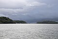
English: The Îles du Salut (also occasionally called by their anglicised name, Salvation Islands) are approximately 13 km off the coast of Kourou, French Guiana. They used to serve as prisons.
Français : Les îles du Salut se situent à environ 13 km de Kourou en Guyane française. Elles servaient autrefois de bagne.
archipelago in French Guiana  | |||||
| Upload media | |||||
| Instance of | |||||
|---|---|---|---|---|---|
| Location | Cayenne, Canton of Cayenne Centre, arrondissement of Cayenne, French Guiana, France | ||||
| Located in or next to body of water | |||||
| Has part(s) | |||||
| Area |
| ||||
 | |||||
Subcategories
This category has the following 4 subcategories, out of 4 total.
N
Î
Media in category "Îles du Salut"
The following 41 files are in this category, out of 41 total.
-
 Antigonon leptopus.jpg 3,648 × 2,736; 2.63 MB
-
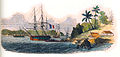 Iles du salut port drawing dessin.jpg 1,181 × 563; 278 KB
-
 Iles du Salut-Carte 1764.png 614 × 746; 805 KB
-
 Iles du Salut-Carte 180x.png 614 × 532; 706 KB
-
 Iles du Salut-Carte 1852.jpg 707 × 800; 190 KB
-
 Iles du Salut.png 690 × 623; 1.23 MB
-
 ILES et BAGNE 046.JPG 1,417 × 1,890; 339 KB
-
 Iles-salut.png 329 × 354; 25 KB
-
 Im Gefängnis, Île du Salut, Franz. Guiana (11970090883).jpg 640 × 481; 251 KB
-
 Island "bagne Kourou".jpg 4,992 × 2,304; 2.96 MB
-
 Island, "bagne".jpg 3,264 × 2,448; 3.06 MB
-
 Kourou beach islands salut.jpg 1,483 × 1,978; 2.64 MB
-
 LE PHARE DES ILES DU SALUT - GUYANE.jpg 946 × 800; 205 KB
-

-

-
 Vincent Jermolière - 6 - Iles du Salut - L'ile Royale, Magasins et Débarcadère.jpg 1,582 × 1,020; 265 KB
-
Îles du Salut 001.webm 3 min 3 s, 1,920 × 1,080; 577.85 MB
-
Îles du Salut 002.webm 1 min 25 s, 1,920 × 1,080; 148.59 MB
-
Îles du Salut 003.webm 50 s, 1,920 × 1,080; 98.15 MB
-
 Îles du Salut 10 June DSC 1155 Sea.jpg 8,064 × 5,376; 13.94 MB
-
 Îles du Salut 10 June DSC 1158 Sea.jpg 8,218 × 5,479; 14.09 MB
-
 Îles du Salut 10 June DSC 1159 Sea.jpg 8,115 × 5,410; 16.43 MB
-
 Îles du Salut 10 June DSC 1160 Sea.jpg 8,232 × 5,488; 14.8 MB
-
 Îles du Salut 10 June DSC 1161 Sea.jpg 8,256 × 5,504; 10.68 MB
-
 Îles du Salut 10 June DSC 1163 Sea.jpg 8,078 × 5,385; 13.51 MB
-
 Îles du Salut 10 June DSC 1164 Sea.jpg 8,256 × 5,504; 14.83 MB
-
 Îles du Salut 10 June DSC 1165 Sea.jpg 8,256 × 5,504; 13.67 MB
-
 Îles du Salut 10 June DSC 1166 Sea.jpg 8,063 × 5,375; 10.75 MB
-
 Îles du Salut 10 June DSC 1168 Sea.jpg 8,194 × 5,463; 9.87 MB
-
 Îles du Salut 10 June DSC 1171 Sea.jpg 8,211 × 5,474; 10.27 MB
-
 Îles du Salut 10 June DSC 1172 Sea.jpg 8,175 × 5,450; 10.95 MB
-
 Îles du Salut 10 June DSC 1173 Sea.jpg 8,188 × 5,459; 10.82 MB
-
 Îles du Salut 10 June DSC 1174 Sea.jpg 8,091 × 5,394; 12.22 MB
-
 Îles du Salut 10 June DSC 1175 Sea.jpg 8,256 × 5,504; 16.64 MB
-
 Îles du Salut 10 June DSC 1176 Sea.jpg 7,712 × 5,141; 13.48 MB
-
 Îles du Salut 10 June DSC 1178 Sea.jpg 8,256 × 5,504; 16.12 MB
-
 Îles du Salut 10 June DSC 1179 Sea.jpg 8,256 × 5,504; 15.02 MB
-
 Îles du Salut 10 June DSC 1180.jpg 8,171 × 5,033; 11.72 MB
-
 Îles du Salut 10 June DSC 1486 Sea.jpg 8,134 × 5,260; 13.03 MB
-
 Îles du Salut depuis la Pointe Pollux.jpg 3,670 × 2,438; 4.94 MB
-
 Îles du Salut.jpg 2,223 × 972; 433 KB


.jpg)


